NASA SMD EO Advancing Agriculture, Flood, Fire, Hurricane, Disaster Preparedness and Extreme weather
One-page briefing for the Nov. 6 discussion with government, industry, and political leaders
Updated Nov 6, 2025Objectives
- Align NASA SMD Earth Observation (EO) infrastructure with priority applications in agriculture, flood risk, disaster response, extreme weather, and wildfire.
- Leverage Goddard capabilities and public private partnerships to deliver near-term impact while informing multi-year investments.
Policy Hooks
High-Impact Questions for the Panel
Strategy and transition
- How is NASA SMD prioritizing EO investments and research-to-operations pathways so applications for flooding and extremes move rapidly into operational use via DAACs like GES DISC?
Observation gaps and interoperability
- Which missions/products will be emphasized to close gaps affecting floods and agriculture (e.g., PACE terrestrial/atmospheric products, ICESat‑2 inland water, SWOT water levels, SMAP soil moisture, NISAR land dynamics)?
- How will space-based observations interoperate with ground networks and hydromet testbeds envisioned in the Weather Act for extreme precipitation and inundation mapping (NOAA Water)?
Flooding and water risk
- What is the plan to integrate near real-time flood mapping (e.g., LANCE MODIS/VIIRS flood products) with OPERA surface-water/inundation services into a unified, low-latency pipeline for emergency use?
Modeling and prediction
- What investments and partnerships are needed to expand NLDAS‑3 and related land data assimilation for regional flood and drought risk, and how will value be demonstrated to user communities?
Agriculture and drought
Disasters (wildfire and landslides)
- Landslides: How will Goddard’s mapped polygons and 1‑km predictions be integrated with utility and infrastructure risk mapping?
- Wildfire — NASA FIRMS reporting and event tracking:
- FIRMS active fire (Ultra Real-Time MODIS/VIIRS) is complemented by the Earth Information System wildfire efforts. How will these be operationalized with NASA Disasters and government stakeholders?
- The Fire Event Explorer provides near real-time progression context. What are plans to scale access via APIs/dashboards for emergency managers, utilities, and county wildfire plans?
- FIRMS is widely used by media and local governments and in peer-reviewed research. How will NASA expand training, guidance (e.g., filtering low-confidence detections), and best practices?
- Roadmap question: how can FIRMS event tracking be blended with weather, fuels, and topography to provide short-term fire spread layers suitable for operations?
Access, training, and equity
- What steps will ensure cloud‑native, low‑latency access through NASA DAACs and expand practitioner training (e.g., ARSET) for local agencies in vulnerable regions (floods, heat, wildfire smoke, water scarcity)?
Visual Context: Recent Disasters
NASA Earth Observation data provides critical situational awareness for these high-impact events.
Hurricane Helene (2024) - Satellite View
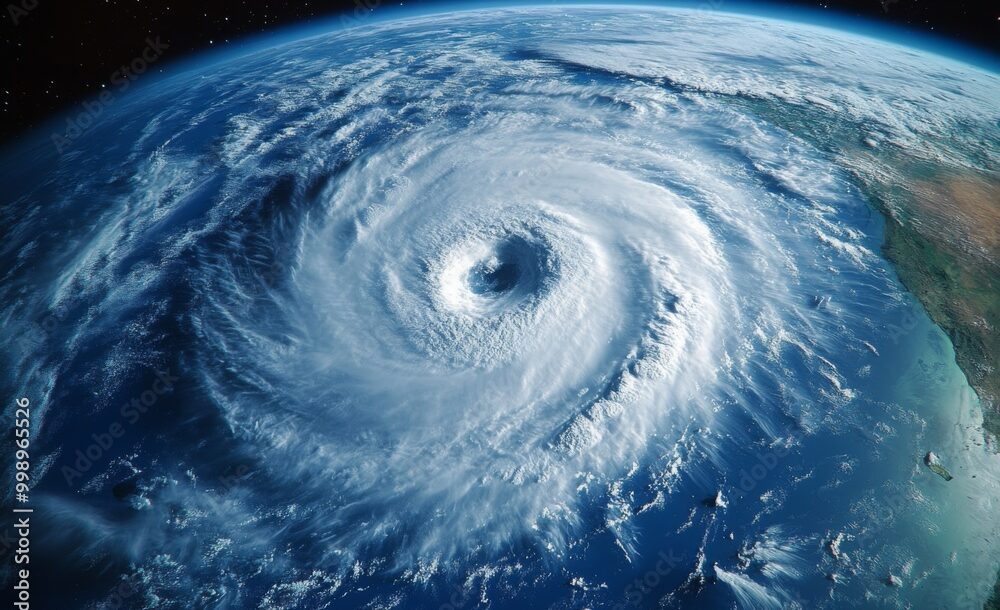
Satellite imagery showing the storm structure and scale, used for tropical storm prediction.
Asheville Flooding (Sept 2024) - Ground View

Ground view of infrastructure impact, complementing satellite inundation maps (e.g., SWOT/LANCE).
Canadian Wildfires (2023) Smoke Plumes
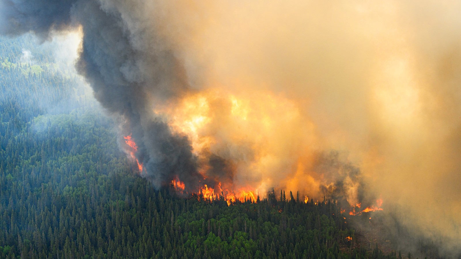
Widespread smoke plumes illustrating atmospheric transport challenges tracked by NASA instruments.
Why This Matters for Goddard (MD‑04)
- PACE community engagement and new terrestrial product insights; GPM public engagement.
- NLDAS‑3 development and GES DISC user support for water extremes.
- ARSET trainings for practitioners.
- FIRMS and NASA EIS wildfire innovations; NASA Disasters collaborations.
- Landslide hazard mapping and predictions with direct relevance to grid and transmission risk.
- Stable appropriations and minimized shutdown disruption are essential to keep these pipelines operational and responsive.
Near-Term Actions to Consider
- Publish an integrated EO-to-application roadmap linking PACE/GPM/SMAP/ICESat‑2/SWOT/NISAR with flood, drought, agriculture, and wildfire use cases through GES DISC and NASA Disasters.
- Resource a pilot to fuse LANCE flood mapping with OPERA products for a unified inundation layer; extend a parallel pilot to surface wildfire layers from FIRMS/EIS in FEMA/NIFC workflows.
- Expand ARSET offerings targeted to county/state emergency managers, utilities, and land managers on FIRMS/EIS usage, including best practices for confidence filtering and interpreting FRP and active segments.
Working Team Contacts
- Aaron Harawa: LinkedIn Profile
- Diana Fontaine: LinkedIn Profile
- Walter Gonzales: LegiStorm Profile
Key Supporting Links
- Congress.gov — Weather Act Reauthorization: H.R. 5089 · H.R. 3816 · S. 5601
- NASA Earthdata DAACs: GES DISC · Earthdata portal · LANCE
- Wildfire & Disasters: FIRMS · NASA Disasters
- Hydrology & Land Surface: NLDAS‑3 · FLDAS · NOAA Water
- Key Missions: PACE · GPM · ICESat‑2 · SWOT · SMAP · NISAR · OPERA
- Training: ARSET
All links point to nasa.gov, noaa.gov, or congress.gov domains.